
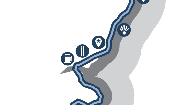
TOP 12 DRIVING ROUTES IN THE UK
Hit the open road this summer on the best driving routes in the UK. We’ve mapped out routes with multiple stops across the UK, making it easier for you to find a route to drive.
Explore scenic driving routes in Scotland, Northern Ireland, England, and Wales and discover the best spots in the UK.


DRIVING TOUR ROUTES IN SCOTLAND
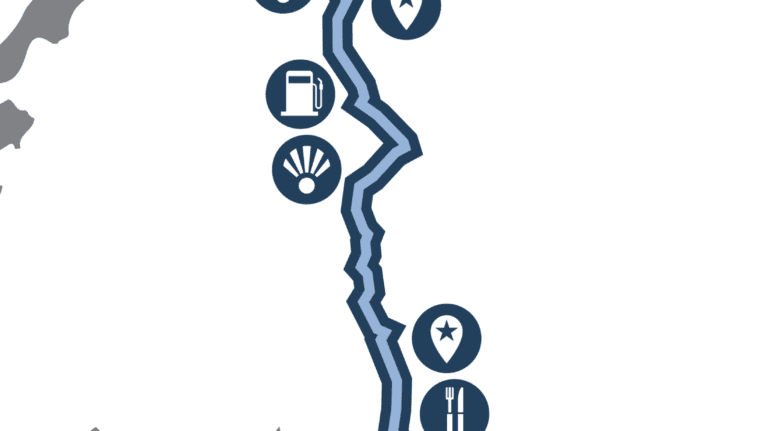
ROUTE 1 : GLASGOW TO GLENCOE

This route from Glasgow to Glencoe explores southwestern Scotland in all its picturesque glory, with the slow transition from metropolitan to rural Scotland making this one of the most scenic road trips in the UK. If you’re planning a driving route for your holiday in Scotland, Glencoe and the surrounding area is a fantastic drive that showcases some of the most beautiful areas of the country, with some fascinating attractions to stop off at along the way.
There are a few places to park up if you want to admire the Loch in all its glory, with several places in Luss to stop for coffee, too. If it’s just a scenic spot you’re looking for, you could park up at the popular Firkin Point, a stunning stop-off with panoramic views of the Loch just over 15 miles along the A82. There are also find toilets here which are available to the public. You’ll find another great viewpoint at the Inveruglas Pyramid, an innovative structure built in 2015 as part of Scotland’s Scenic Routes project. The Pyramid is made up of 31 steps which, from the top, offer picture-perfect views of the Loch.
Further along the A82, you may want to stop off for a short walk to the Falls of Falloch. You’ll find a signposted car park just south of the waterfall; the walk from the car park is estimated to take around 20 minutes, giving you a good opportunity to stretch your legs and appreciate the surrounding area. There are also picnic benches by the falls which are perfect if you want to take some snacks.
Further along your drive, you’ll pass Pulpit Rock, an unusual looking rock which is viewable from the road. The Rock was historically used as a place of worship during the 19th century, and is also known in Gaelic legend as Clach nan Tarbh or ‘The Stone of the Bulls’. If you want to explore more Scottish legends along your drive, you could also take a small detour to The Lochan of the Lost Sword, a small loch which is said to be the resting place for a number of ancient Scottish swords belonging to figures such as Robert the Bruce. There’s parking available at Tyndrum Lower train station or Pine Trees camping site, from which you’ll have to hike to the Lochan; it’s an easy walk which is suitable for all fitness types.
Your journey will continue north, where you’ll pass Lochan na h-Achlaise on your left and the larger Loch Ba on your right; you can stop off at Loch Ba viewpoint for the best view of the water and rolling Scottish mountains. There’s also another viewpoint further along your route at Rannoch Moor Viewpoint, which has a marked car park for you to park up and admire the beauty of Rannoch Moor.
As you near Glencoe, there are plenty of car parks dotted along your drive where you can truly appreciate the surrounding area. Glencoe Valley Viewpoint has a spacious car park on the side of the road, and is a wonderful place to take some pictures of the Scottish mountain backdrop and winding waterfalls. Your journey will finish in Glencoe, known as one of the most beautiful glens in Scottish Highlands, and a wonderful place to finish your drive.
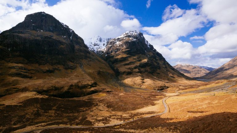
Glencoe Valley, with Buachaille Etive Mor dominating the skyline
WHAT TO EXPECT ON THIS JOURNEY
 The bonnie, bonnie banks of Loch Lomond
- The route is inland but does drive along the length of a couple of large bodies of water (Loch Lomond, Loch Tulla), crosses over the famous River Clyde, and as you drive along Loch Lomond’s edge you can enjoy views across the water and over to Ben Lomond mountains.
- The route follows an A-road (a well built-up road, one below a motorway), however, weather conditions will inevitably be variable so it is worth checking weather conditions on your day of travel.
- There are also lots of locations to stop at, either for sightseeing or entertainment (cafes, activities, etc.).
- As you drive closer to Glencoe, the views from the car are postcard perfect. The magnificent views and countless stop-off points around the Glencoe area truly make this one of Scotland’s most scenic driving routes.
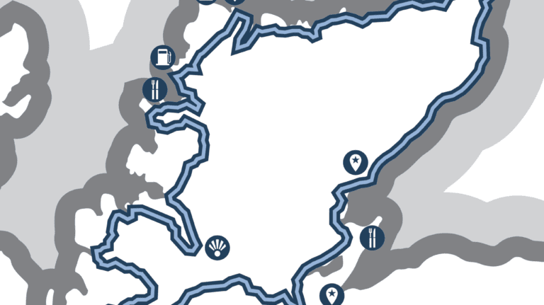
ROUTE 2 : NORTH COAST 500

One of the most famous driving routes in the UK, the Scottish North Coast 500 is a must for any road trip list. The route begins at Inverness Castle and – as the name suggests – promises around 500 miles of beautiful beaches, scenic spots, castles and distilleries. We’ve jotted down a few of our recommended stops, although the list of potential activities is almost endless. Ideally, you’ll want to set aside a week or two to truly appreciate the beauty of this trip and see all that Scotland’s north coast has to offer.
THE ROUTE
Your journey will begin at Inverness Castle, which in itself is a great place to visit. First built in the 11th century, the Castle is an impressive sandstone structure which you can visit at the start or end of your drive. From the Castle, you’ll drive north along the east coast along the A9 across the Cromarty Bridge. Around 37.5 miles into your journey, you’ll come across Glenmorangie Distillery, arguably one of the most famous distilleries along the North Coast 500 route.
There are a few other distilleries along your road trip which are well worth a visit, too. Clynelish Distillery, Old Pulteney Distillery, and Wolfburn Distillery are all within easy reach of the road, and would make a great stop for anybody interested in knowing more about Scotch Whiskey.
Around 17.5 miles from Glenmorangie Distillery, you’ll find Dunrobin Castle and Gardens, which is a perfect spot for any Scottish history enthusiasts. Dunrobin Castle is the largest great house in the Northern Highlands, boasting beautiful gardens and stunning coastal views. There are a few other castles dotted along your journey too, such as the Dunbeath Castle and Gardens on the east coast of Caithness, as well as the nearby Castle and Gardens of Mey. All the castles and grounds along your route have car parks and, as castles are an integral part of Scotland’s history, promise a rich insight into what made Scotland’s north coast what it is today.
Your drive will follow the A9 along the east coast, breaking off onto the A99 at Latheron. The A99 is a straightforward drive which will lead you to the legendary John O’Groats, a village famous for its north-eastern tip which, together with Cornwall’s Land’s End, forms the longest distance on mainland Britain. This is a popular place to take a picture to remember your journey!
From John O’Groats, follow the A836 westward across the northern coast of Scotland. This is a beautiful section of the drive; you’ll be able to see for miles across the Highlands as the road winds its way across the rural north. Eventually, you’ll break away from the A836 onto the A838, which will take you over the Kyle of Tongue Bridge, dip under Loch Eriboll, and continue on to Durness.
Here, there’s a fantastic scenic spot at Sango Bay Viewpoint, where you can park up and admire the sandy beach and turquoise water of Sango Sands. There are plenty of stunning beaches to take advantage of on your drive down the west coast, such as Clachtoll Beach in Sutherland, Mellon Udrigle Beach north of Gairloch, and Applecross Beach, which is at the southern end of your drive.
Your journey down the west coast will take you through some wonderful Scottish villages and towns, including Lockinver, Gairloch, Fearnbeg, Applecross and Strathcarron, all of which are a wonderful way to experience Scottish culture. The west coast drive may be slightly more difficult than the east coast roads, especially when taking into account the famous Applecross Road, which can prove to be quite challenging.
The last leg of your journey will be the southern stretch from the west to east coast, back to Inverness Castle. Although slightly out of your way, Loch Ness is just 13.2 miles away from the Castle if you fancy one last adventure. As one of the most famous lochs in all of Scotland, Loch Ness is a beautiful place to visit, with plenty of car parks, cafés and scenic spots dotted around its edge – it would make the perfect end to your North Coast 500 trip.
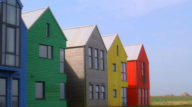 The colourful houses of John O’Groats
WHAT TO EXPECT ON THIS JOURNEY

- There are a range of different types of roads that visitors will travel on when exploring this region of Scotland, but the majority of roads are country roads. Visitors should familiarise themselves with the Highway Code, with particular attention to navigating single track roads.
- While many of the roads on the North Coast 500 route are easy to navigate, there will be some challenging roads as the road weaves in and out of Scotland’s rugged coastline.
- Applecross Road is one of Scotland’s most famous routes, for its beauty and unusual shape. However, Applecross road can be quite challenging for some drivers, so do take your time and enjoy the views as you navigate your way.
- Due to the length of this road trip, it’s advisable to take an emergency breakdown kit with supplies such as food, water, a torch and warm waterproof clothing.
ROUTE 3 : EDINBURGH TO THE ANGUS COAST

This route is an extension of the famous Angus Coastal route, and instead begins in Scotland’s stunning capital of Edinburgh. From here, the route will take you over the Queensferry Crossing into Dundee, through the Kingdom of Fife and onward to Aberdeen, with plenty of places to stop off and explore what the Scottish east coast has to offer. If you’re looking for a scenic driving route for your UK holiday, the east coast of Scotland is definitely one to consider!
THE ROUTE
Your route will begin in the beautiful capital of Edinburgh, home to Edinburgh Castle: a wonderful place to explore the history and culture of Scotland. The castle is over 900 years old and still stands proudly on the imposing Castle Rock, although if you want to walk around the castle you may need to book in advance.
From Edinburgh, your route will follow the A90 towards The Queensferry Crossing, one of three famous bridges connecting Edinburgh to Fife. Your journey will take you northward along the east coast, where you’ll drive through Aberdour. This idyllic seaside village is well worth a visit and is a picture-perfect place to stretch your legs.
car
If you fancy a walk on the beach, the beautiful Silver Sands Beach is within easy reach of your route, or for those who enjoy castle visits, Aberdour Castle is a great place to explore some more Scottish history. The castle is arguably one of the oldest in Scotland, and boasts charming gardens which are perfect for a leisurely stroll.
Your journey along the east coast is made up of A-roads, making the drive a reasonably straightforward one. The views are stunning, with plenty of places to park up and appreciate the scenery before you. Just over 30 miles from Aberdour, you’ll reach the characterful seaside town of Elie. Here, you might want to stop off at Elie Beach, a popular place for water sports, rock climbing and outdoor activities. Just remember to take a towel if you decide to go for a swim! If you’re feeling peckish after your visit to Elie, the small town of Anstruther is only 6 miles further along your route, and is famous for having the best fish and chips in all of Scotland.
Just 14 miles further into your journey, you’ll drive through St Andrews, famous for its prestigious university and multiple golf courses. For any golf enthusiasts, this is a wonderful place to stop and explore. You can take a tour through the British Golf Museum or visit The Old Course – also known as The Old Lady – which is considered to be the oldest golf course in the world. There’s also a beautiful beach nearby called West Sands Beach; the sand stretches for almost two miles, making it the perfect place for a seaside walk. St Andrews also boasts a stunning 8-acre Botanic Garden, which is only a stone’s throw from the beach and close to the centre of town.
From St Andrews, your driving route will continue through Fife and across the Tay Road Bridge into the city of Dundee. This will mark the second leg of your journey between Dundee to Aberdeen, otherwise known as The Angus Coastal Route, one of Scotland’s most popular drives following the length of the A92.
If you want to stretch your legs before tackling The Angus Coastal Route, there are plenty of places to stop off in Dundee, with cosy cafes, restaurants and shops to browse through. The Victoria and Albert Museum is well worth a visit, too. Located on the water’s edge and boasting a remarkable exterior, this museum was in fact the first design museum to be opened in Scotland.
From Dundee, your journey along the A92 will take you through a number of charming villages and seaside towns, one being the town of Arbroath. Here, you might want to visit the historic Arbroath Abbey where, in 1320, Scottish nobles wrote the Declaration of Arbroath announcing Scotland’s independence from England – arguably one of the most famous documents in Scottish history. Although the Abbey is currently closed, you can still explore the grounds and take some pictures of its imposing structure.
There are plenty of scenic spots to park up and admire the view on your way to Aberdeen, such as St Cyrus Beach, a picturesque sandy beach which is only a short walk from the road. St Cyrus National Nature Reserve viewpoint is just a stone’s throw away from here, and offers stunning panoramic views of the Angus coast from your car. If you fancy exploring more of the coastline before your journey ends, try stopping off at Dunnottar Castle, a popular tourist attraction located a couple of miles south of Stonehaven. The medieval fortress sits on a rocky outcrop, and strikes an imposing figure on the rugged coastline. There are quite a few steps to climb to get the castle, which might be something to keep in mind, although the climb is definitely worth it to see the beautiful views of the Angus coastline.

WHAT TO EXPECT ON THIS JOURNEY

- This route will see you following motorways and A-roads for the majority of the trip, meaning the roads are well established and easy to drive.
- The speed limit on both motorways and A-roads is 70 miles per hour. At various points, speed limits may change as you pass through towns, villages and built-up areas.
- Be mindful of speed limit changes and weather forecasts. The weather can be quite changeable in Scotland and roads can become slippery when wet, meaning drivers may need to adjust their speed accordingly.
- There are lots of places to stop on this route, for food, activities and views, as this region of Fife is extremely scenic and the views out over the water are incredible. Heading up the Angus Coast Way, you’ll enjoy even more picture-perfect views from the car.
DRIVING TOUR ROUTES IN NORTHEN IRELAND
ROUTE 4 : THE CAUSEWAY COASTAL ROUTE

Everyone’s heard of the Giant’s Causeway, but the Northern Irish coast has much more to offer. From the dramatic cliff-walk of The Gobbins, to Glenarm Castle, the ancestral home of the Earls of Antrim, the north Atlantic coastline is studded with gems both historical and geological. If you’re planning a driving trip around Northern Ireland, this route is definitely one to consider, with multiple stops along the way so you can see as much of the north coast as possible.
THE ROUTE
Heading north out of Belfast on the M5, you’ll join the A2 Shore Road and quickly reach Carrickfergus Castle, which dates back to Norman times. The castle remains one of the best-preserved medieval structures in Ireland, and is worth a stop for history fans. But, if it’s geological features you’re interested in, carry on another 6 miles and you’ll reach the visitor centre for The Gobbins, a coastal structure formed by volcanic and ice age activity.
The dramatic Gobbins Cliff Path exists thanks to visionary engineer Berkeley Dean Wise, who had the network of tunnels and bridges constructed in the early 1900s. The Gobbins is only accessible as a guided tou\r, so be sure to book ahead if you want to take in this unique experience.
Heading back onto the A2 and north toward Larne, you may choose to stop off at Carnfunnock Country Park for a stroll around the walled garden, maze or woodlands. 8 miles further along the coast road you’ll reach Glenarm Castle, still home to the McDonnell family whose ancestral seat has been in the Glens of Antrim since the 17th century. The castle has quite a history – burned in 1643 by anti-royalist Scots, it was rebuilt over 100 years later and boasts extensive and beautifully-kept gardens. If you fancy seeing Glenarm Village on a different set of wheels, you can even hire an e-bike!
Our route continues along the A2 with the Atlantic on your right; you’ll pass Carnlough beach, and there’s a small filling station at Glencloy if you need to top up. There are plenty of pubs and cafes near Carnlough Harbour if you also need a pit stop for food!
If you fancy a cave exploration without the need for a guide, the Cushendun caves can be easily accessed from the beach at Cushendun. They’re not as extensive or impressive as The Gobbins, but this is one of several spots along or near the Causeway Coastal Route that have featured in the HBO series Game of Thrones, as the cave where Melisandre gives birth to the killer shadow.

Ballycastle is your next waypoint, and it would be remiss of us not to mention that you could take the ferry out to Rathlin Island, the northernmost part of Northern Ireland and with a population of less than 150 people. The Boathouse Visitor Centre displays artefacts from shipwrecks around the island, and can also point you in the direction of some of the walks the Island has to offer.
GoT fans might want to detour after Ballycastle, to visit the Dark Hedges – this avenue of ancient beech trees also featured in Game of Thrones, as the Kingsroad. Gracehill House, the Georgian Mansion the avenue was planted to lead up to, is now a golf club.
If you stay on the A2 out of Ballycastle, you can either take the quick, inland route to Giant’s Causeway, in which case it’s about 13 miles – but if you prefer to keep it coastal, the B15 will take you up through Ballintoy and past the National Trust site Carrick-a-Rede, where a rope bridge connects the mainland with a rocky island outcrop.
The Giant’s Causeway Visitor Centre is the best place to see the Giant’s Causeway, with 360-degree views of the coastline and audio tours of the area which combine science and nature in one thrilling visit. The energy-efficient Visitor Centre is a fascinating structure in its own right, with its modern, imposing architecture striking an impressive image against the backdrop of the coastline. To visit the centre, you’ll need to book in advance.
From the Giant’s Causeway Centre, your driving route will continue west along through the town of Coleraine, which is a good place to stop for a bite to eat on the banks of the River Bann flowing through the centre of town. From here, the A2 will take you toward the coastline, where you’ll find Mussenden Temple; a small but impressive circular structure built in 1785 and now owned by the National Trust. If you fancy stretching your legs, Mussenden Temple & Downhill Demesne park is only a short walk from the Temple, or you could head down towards Downhill Strand Beach, one of the longest beaches in Northern Ireland stretching 7 miles along the coast.
Once you’re ready to hit the road again, the A2 will take you further along the coast, passing the majestic Binevenagh peak before reaching your final destination of Londonderry. There’s plenty to do in the city, with restaurants, cafes and shops to browse through if you have a couple of hours to spare. The famous Derry Walls are also near the centre of town, and are a great last stop to finish your Coastal Causeway driving route.

Giant’s Causeway, created by an ancient volcanic eruption
WHAT TO EXPECT ON THIS JOURNEY

- The route covers the Coastal Causeway, with some breath-taking stops along the way so that you can truly appreciate what the north coast has to offer.
- The route is mostly made up of A-roads, meaning the roads aren’t too challenging to drive – although you’ll want to take your time so you can stop off and admire as much of the scenery as possible.
- It’s advisable to plan your Northern Ireland driving route in advance and book tickets to any attractions you may want to visit in advance.
- Although you may choose a sunny, dry day to take your route, it’s always wise to take a few extra layers if you’re planning on going for a walk or in case of any car trouble.
ROUTE 5 : FERMANAGH LAKELANDS ROUTE

This driving route will follow the Fermanagh Lakelands in Northern Ireland, which are among some of the most beautiful and most visited landscapes in the country. Situated toward the South-West border with Ireland, the River Erne winds through the lakelands creating both Upper and Lower Lough Erne, which have defined the landscape for centuries.
THE ROUTE
Your route around Lower Lough Erne, the larger of the two lakes, starts in historic Enniskillen, built in the early 15th century by the Maguire chieftains. If you fancy spending some time in Enniskillen itself, you could find out more about its history at the Fermanagh County Museum, situated in Enniskillen Castle, or take a boat tour from Brooke Park. However, with nearly 60 miles of lakeland driving ahead, you may be keen to get onto the road – there’ll be no shortage of views along the way.
Following the A46 Lough Shore Rd northwest out of the town, with the Lough on your right, you’ll pass Lough Erne Golf Resort and Carrickreagh viewpoint, a picturesque lakeside stop in Elylodge forest. Carrickreagh is a nice stop for a stroll but the lake view is somewhat blocked by nearby islands in the Lough; if it’s sweeping views you’re after, you’ll want to head further up the A46 and drive up to Lough Navar Forest Viewpoint, 300m above the lake and accessible by car. You’ll pass the remains of Tully Castle on your way before turning left onto Church Hill Road and following it up.
The viewpoint is on the top of the Magho Cliffs, a limestone escarpment formed by glaciers and dominating the southern shoreline. You can either drive back down to follow the lakeside route into Belleek, or take the scenic Lough Navar forest drive which will take you further south before putting you on Glennasheevar Road and the B52 into the town, which sits across the River Erne.
The viewpoint is on the top of the Magho Cliffs, a limestone escarpment formed by glaciers and dominating the southern shoreline. You can either drive back down to follow the lakeside route into Belleek, or take the scenic Lough Navar forest drive which will take you further south before putting you on Glennasheevar Road and the B52 into the town, which sits across the River Erne.

Belleek Pottery Visitor Centre is well worth a visit at this point in the journey. Established in 1857, Belleek Pottery has produced fine Parian china using traditional methods for generations. Visitors can see historic pieces in the museum, learn more about the craft in the video theatre and enjoy a break in the tearooms.
For those interested in finding somewhere for lunch at this point in the journey, you could pop along Main Street to The Thatch, a quaint thatched cafe, or the Lemon Tree coffee house and sandwich bar, both of which have excellent reviews on Tripadvisor.
Heading out of Belleek on the A47 to continue the lakeside route, now heading East, the Boa Island road will take you through Leggs past Castle Caldwell forest, an ancient woodland area some 200 hectares on the nearby peninsular. Stop off to see the 16th century castle ruins if you fancy, or continue heading northeast and take the A47 across Boa Island itself, the largest island in Lough Erne.
When you reach Letterkeen, join the A35 heading West and then fork right onto the A47 again, heading back toward the lake out of the town. After you pass through Lisnarick, you’ll want to take a right at St Patrick’s Church to reach your next destination: Castle Archdale Country Park.
While Castle Archdale is home to a caravan and lodge park, there’s plenty to see without being a staying guest. The countryside centre and War Museum at Castle Archdale are well worth a visit – Lough Erne housed the westmost flying-boat station during WWII, protecting allied forces from U-boats in the North Atlantic. There’s also plenty of woodland to explore, with a network of walks. You can also book watersports and hire a boat, or take the ferry out to the White Island to see the remains of a 12th century church.
The remaining route along the West side of the Lough takes you some 8 miles back toward Enniskillen, where a final destination awaits – the monastic settlement on Devenish Island, accessible by ferry from Trory Point. Founded in the 6th century, raided by Vikings in the 9th, and flourishing in the Middle Ages as an Augustine Priority, there are ruins on the Island from the different time periods of the settlement. You can take a guided tour or simply take a water taxi over and explore for yourself.

WHAT TO EXPECT ON THIS JOURNEY

- The route largely follows the coastline of Lower Lough Erne, but the road is not lakeside for the entire journey so some of the route will be greener / wooded.
- The drive takes you through some small populated areas and a couple of towns, as well as across one of the northern islands in the lake. There are numerous scenic and historic stops, as well as places to eat along the route.
- The route is mostly well-kept A roads, meaning the drive won’t be too challenging. However, as with any road trip, it’s advisable to pack an emergency breakdown kit in case the worst happens. Include supplies such as food, water, a torch, and waterproof clothing, plus any tools you’ll need to change a tyre. It’s also a good idea to keep the contact number of your emergency breakdown provider close to hand.
DRIVING TOUR ROUTES IN ENGLAND
ROUTE 6 : THE PEAK DISTRICT PASSES

This drive joins both the Snake Pass and Cat and Fiddle Pass, forming a route which winds its way around the beautifully scenic Peak District. Fitting to its name, Snake Pass is full of twists and turns, and is especially famous for its professional cycling routes, including the Tour of Britain. The second leg of the journey is Cat and Fiddle Pass, which gains its name from the Cat and Fiddle Inn that used to operate at the summit of the road.
THE ROUTE
Your route begins in the idyllic town of Glossop and follows Snake Road (a small section of the A57) through the north-western part of the Peak District. Originally built as a link between Sheffield and Manchester, Snake Pass is now one of the most famous drives in Britain, known for its winding shape and thrilling views.
Just under 4.5 miles along the Pass ascent, those who enjoy challenging walks might favour a trip to the B-29 Overexposed crash site; the remains of a B-29 Superfortress which crashed in 1948. The debris has been purposefully left at the site as a memorial to the 13 crew members and is a lengthy walk of around 3.5 miles for those who are prepared to venture away from the road. You can park up at the layby on Snake Pass, and follow either the Pennine Way trail to Bleaklow Head, towards the Higher Shelf Stones, or take the Doctor’s Gate trail from Snake Road. Just remember to wear appropriate footwear!
Your drive continues along the winding road of Snake Pass towards Ashopton. On the way, you’ll find a great scenic spot at the Derwent Dam, with stunning views of the Ladybower Reservoir and surrounding area. You might also enjoy a trip to the Upper Derwent Visitor Centre, which is only a short distance from the dam itself.

From Ashopton, head south toward Heatherdene, another great scenic spot where you can park up and admire the views of the reservoir. There are also toilets near the car park which are available for public use. Your route heads further south, through the villages of Bamford, Hope Valley, and Hathersage; all perfect places to stop and fuel up or grab a bite to eat.
If you fancy a short walk to stretch your legs, Surprise View Car Park is within easy reach of your route and is one of the most famous viewpoints on your drive. Showcasing the rolling hills of the Peak District, this is a great place to fully appreciate the scenery. If you want to explore the area, try stopping off at the National Trust Longshaw Estate a few minutes down the road, which has some walking trails through the District moors.
Our Peak District road trip route continues westward through the Peak District, towards the majestic Chatsworth Estate. There’s plenty to do here; you can take a leisurely stroll around the Chatsworth Gardens, or visit the stunning Chatsworth House. The House itself is stunning to behold, and is home to the Duke and Duchess of Devonshire. It’s also quite famous, with a few notable TV appearances in films such as Pride and Prejudice, The Duchess and the BBC series Death Comes to Pemberley. You can also take a few pictures of the 60-foot Emperor Fountain, which was installed in 1844 in preparation for a visit from Tsar Nicholas II. Although the visit didn’t go ahead, the fountain remains – and was even named after him.
Further along your drive, you’ll drive through the spa town of Buxton, famous for its mineral water and the system of limestone caves at Poole’s Cavern and Buxton Country Park. This is an incredibly interesting place to stop and explore the underground caves, with a car park onsite, as well a picnic area and a café. If you’re feeling peckish, Buxton is also home to the local favourite The Cheshire Cheese, which offers a great range of traditional pub food and vegan options.
The last leg of your Peak District journey will be the Cat and Fiddle Pass, known as one of the most dangerous roads in Britain due to its severe twists and turns. Part of the attraction of driving Cat and Fiddle Pass is that it’s quite a challenging drive, and is in fact sometimes referred to as ‘The Widow Maker’. It’s wise to drive this road carefully and take your time, as the route is also popular with bikers and cyclists.
Your route will end at the locally famous Cat and Fiddle, which used to be the second highest public house in England. The Inn has now been transformed into a distillery, making it the highest of its kind in England. There are also plans in the works to change the name to the ‘Cat and Fiddle and Weasel’, so it will be easy to spot when you’re on the road! There’s a small café and shop onsite too, if you fancy something warm to drink. The distillery is actually at the peak of the Pass, so for those who want more of a drive, simply continue along the Cat and Fiddle Pass until you reach its end.

WHAT TO EXPECT ON THIS JOURNEY

- Snake Pass isn’t as dangerous as Cat and Fiddle, but there are several twists and turns in the road, as well as blind summits. Cat and Fiddle Pass is the more challenging of the two Passes, as it has a lot of hairpin bends to watch out for.
- When driving the route, bear in mind that it’s also quite popular with cyclists and motorcycles, especially when there are good weather conditions.
- It’s important to never try and navigate either Pass if the road has been closed. This is normally the case when there is snow or heavy rain, as the route can be incredibly treacherous for drivers. It’s always best to prepare for the route in advance and choose a sunny, dry day.
ROUTE 7 : JURASSIC COAST AND DARTMOOR

Clocking in at almost 100 miles, this driving journey combines the famous Jurassic Coastal Drive and a hand-picked route through the picturesque Dartmoor National Park. The Jurassic Coastal Route is a well-known driving route in the UK for tourists and locals alike, offering breath-taking views of England’s southern coast. This will make up the first leg of your journey, and follows a small section of the locally famous Poole to Exeter route. The second leg of your route will take you through the bustling city of Exeter, before finally reaching the scenic landscape of Dartmoor National Park.
THE ROUTE
Your route will begin in the seaside town of Weymouth and continue on to Abbotsbury, where you can appreciate the green fields and rolling hills along the coast, occasionally being able to catch a glimpse of the sea. Abbotsbury itself is a beautiful village, with lots on offer. Abbotsbury Swannery is the first attraction you may want to visit, and is the world’s only managed colony of nesting mute swans. Just under two miles away is Abbotsbury Subtropical Gardens, a lovely spot to take a walk. Abbotsbury Swannery and Abbotsbury Subtropical Gardens offer a joint 25% off ticket if you visit both, but you will need to pre-book your visit online to see either attraction. To fully appreciate the view from the coast in Abbotsbury, you could park up at the stunning Abbotsbury Hill Beauty Spot, which is just one mile from the Gardens.
If you’d like to explore the coast on foot, the picturesque Cogden Beach is only 4 miles away, with a car park that is easily accessible from the road. Likewise, you could stop off at East Beach Car Park instead, which is slightly further along your route and a beautiful place to see the West Bay and Jurassic Coast Cliffs up close. Your drive will take you along the coast to Lyme Regis, which is famous for its fossil-filled beaches. You can even try to find one for yourself at the Lyme Regis Fossil Beach, which is only a short walk from the Monmouth Beach Car Park.

From Lyme Regis, your route will take you past the seaside towns of Seaton and Sidmouth, both of which are great places to stop for a bite to eat or to refuel your car. From here, you could also take a short detour to Budleigh Salterton Beach in Kersbrook. The pebble beach is especially popular with tourists, and is well-known for its expansive views of the surrounding area. Just remember to take a towel if you’re planning on going for a swim!
From Kersbrook, you’ll head towards the bustling city of Exeter. Your route will take you across Exeter on the M5, although if you want to make a stop in Exeter simply take the A379 exit on the Sandygate Roundabout. There’s plenty to see in the city, and it’s proved to be quite the tourist attraction for those visiting the south. For those who enjoy a bit of history, you might enjoy a stroll around the house and gardens of Powderham Castle, one of Devon’s oldest country houses located on the west side of the River Exe.
The last leg of your journey will be through the scenic Dartmoor National Park. As you enter the Park, the road may be quite challenging due to blind bends and being quite narrow in some parts. If you want to park up and see some of the scenery, Canonteign Falls is a beautiful spot and is easily accessible by car – although you may need to check what time it is open, as there are gates in place at the entrance.
Your journey will continue through the Park, and the road will remain quite narrow until you reach Tottiford Reservoir, which is a good place to park up and admire the water – they also have picnic benches on site if you’ve packed some food. Once you’ve moved on from the reservoir, the road will open up slightly and you can truly begin to appreciate the serene beauty of the Dartford moors. If you’d like to stretch your legs and admire the scenery on foot, you can park up in Bellever Car Park and take a wander through Bellever Forest, which is well-known for its picturesque woodland trails.
Your route will finish in the village of Yelverton; here, you could take a final stop at Yelverton Rock, a stunning viewpoint just a short distance from your journey’s end. A huge rock outcrop, Yelverton Rock is open all year round to the public, and makes for a great place to stop for a picnic and admire the beauty of the area.

WHAT TO EXPECT ON THIS JOURNEY

- This driving route offers magnificent views of the Jurassic Coast and the surrounding area, which can sometimes be quite distracting. It’s important that drivers focus on the road at all times and safely park up at the various viewing points along the route to admire the view.
- Once you reach Dartmoor, be prepared for a few narrow roads and some blind corners. You may need to take your time during this stretch, although the road will soon open up, with the rolling Dartmoor moors on either side of you.
- There are plenty of places along the route to stop for food or petrol, as well as electric charging stations dotted throughout your drive – although you may want to fuel up before entering Dartmoor National Park.
- Always remember to take an emergency breakdown kit on any road trips, with supplies such as food, water, a torch, and warm waterproof clothing. It’s also advisable to keep the contact number of your emergency breakdown provider handy.
ROUTE 8: HARDKNOTT AND WRYNOSE PASS

A road trip challenge featuring one of the steepest roads in Britain, this isn’t a drive for the faint-hearted. A 64-mile round trip, this route will take you through the heart of the stunning Lake District, through Duddon Valley, then continues from Little Langdale to Ambleside, around Windermere, and finally through Coniston to Muncaster. The drive itself takes less than three hours to complete, and combines both the famous Hardknott Pass and Wrynose Pass; each one an exhilarating drive in its own right.
THE ROUTE
Your drive will begin in Eskdale and follow the road east alongside the winding River Esk. However, if you’d like to take in some of the famous scenery of the Lake District before your drive gets underway, you could visit the Stanley Ghyll waterfall – one of the finest in the area, and standing at an impressive 60 feet tall. There’s a walk of around 1.2 miles from the car to the waterfall, so make sure you take your walking boots!
Forming a single-track road through the Lake District, both Hardknott and Wrynose Passes are dubbed the ‘most outrageous roads in Britain’ by locals. And, with its 33% gradient making Hardknott Pass one of the steepest drives in the UK, this is definitely a route you’ll want to prepare your car for.
As you drive from Eskdale to Hardknott Pass, you’ll come across Hardknott Roman Fort; a wonderful place to explore for those who enjoy a bit of history. The fort – otherwise known as ‘Mediobogdum’ – was said to be one of the most remote postings in the Roman Empire, and overlooks the pass which forms part of the Roman road linking Ravenglass to Ambleside, and Brougham to Penrith. It involves another short uphill walk, so again, make sure to take suitable footwear if you decide to stop off.

From the fort, continue along the road until you reach Hardknott Pass. The ascent can be tricky, but promises fantastic scenery of the surrounding Fells. At the end of the Pass, turn left to begin your downhill descent on Wrynose Pass, which will take you through the quaint village of Little Langdale. At the end of Wrynose Pass, turn left on the A593 and continue along the road, over the Skelwith Bridge across the River Brathay. Here, you can take a small detour to Skelwith Force, a great spot to get out and stretch your legs, as well as admire another of the Lakes’ stunning waterfalls.
Your route will continue along the A593 until you reach Ambleside, which has a petrol station in case you need to fill up. And, if you’re hungry, why not choose from one of the many restaurants in the town? For pub food, there’s the highly-rated Priest Hole, or for vegetarian options you could opt for the cosy Copper Pot café. Once you’ve finished exploring Ambleside, follow Borrans Road towards the legendary Lake Windermere.
Windermere is a breath-taking part of the Lake District, and a staple of any Lakes driving trip. There are plenty of places to stop and enjoy a picnic along the Lake, such as Queen Adelaide’s Hill which is right next to the shore. Or, if you’d prefer to take a short walk, why not follow the B5284 to Brant Fell, which has a fantastic viewpoint of the Lake and the surrounding area.
As you drive towards the southern end of the Lake, keep your eyes open for The World of Beatrix Potter attraction, which is an exciting stop for any drivers travelling with families. For car enthusiasts, we also recommend a trip to the Lakeland Motor Museum at the southern end of the Lake. They have an impressive collection of classic cars, motorbikes, bicycles, pedal cars and motoring memorabilia. There’s also an exhibition showcasing the land and water speed record activities of Sir Malcolm Campbell and his son Donald, which is a must-see for anybody interested in motoring history.
Towards the end of your route is Muncaster Castle, a Grade I listed building and the perfect stop if you want to take in some history at the end of your journey. The Castle is incredibly well-preserved, and still has residents living there. It’s also supposedly one of the most haunted castles in Britain!

WHAT TO EXPECT ON THIS JOURNEY

- The Lakes route is fairly straightforward and promises a wealth of scenic stops, breath-taking views of the Lake District, and a host of fun activities. The most challenging aspect of your journey will be the ascent up Hardknott Pass, with some parts of the road having a 33% gradient. The Pass is actually quite short, at just under 1.5 miles – although the winding road could make it seem longer than it is. The Pass isn’t usually very busy, so you could have the entire road to yourself as you enjoy the stunning views.
- It’s also important to keep in mind that some stretches of your drive can be quite solitary. So, while you might be able to enjoy the road for yourself, it’s even more important to take a car you’re confident will make the journey – and to take supplies such as a phone, blanket, and food and drink.
ROUTE 9: THE COTSWOLDS DRIVE

This driving route will take you through the heart of the Cotswolds, giving you the full view of the green fields and a picture-perfect countryside landscape. There aren’t any tricky roads to watch out for along the way and, although it can get slightly narrow in places, the route is pleasant and straightforward. It is also estimated to take less than two hours of driving, which will give you plenty of time to stop off at the various attractions you’ll pass en route.
THE ROUTE
Your route will begin along the A44, and follow the road towards the north eastern part of the Cotswolds. Upon entering the Cotswolds area, you’ll first drive past the grounds of Blenheim Palace, which is a great place to visit at the start of your journey. The Palace is a World Heritage Site, and famous for being the birthplace of Sir Winston Churchill. There’s something to pique everybody’s interest here, too; you can visit the Rose Garden, see the Palace itself or even take a few pictures of the legendary Harry Potter tree, also known as the infamous Whomping Willow. The Palace has also featured in a few well-known films such as Harry Potter and the Order of the Phoenix, Spectre, and The Avengers. And, if that doesn’t interest you, why not try and work your way around the Marlborough Hedge Maze – although you may want to set aside some time for that one!
Your drive will continue along the A44, before you’ll take a left turn on the B4437. There’s a petrol station on the corner here which could be a good place to fill up along your route. The drive is a scenic one, with luscious green fields on either side of you, and an arrow-straight road leading you directly towards the small village of Stonesfield. You’ll find a number of quaint countryside villages and towns along your way; from Stonesfield, your route will take you through the centre of Fawler, then up to the town of Charlbury.
The roads between each location are fairly easy to navigate, with scenery to enjoy on either side of the road. If you’re feeling peckish, you may want to stop off at one of the inns at Charlbury for some traditional pub food. For history enthusiasts, Ascot d’Oilly Castle is located just under 5 miles away from the centre of Charlbury. Only a fragment of the castle remains today as a Grade II listed building.

From Charlbury, your route will continue along the B4437 until you reach the right turn for Pudlincote Lane and head towards the small village of Churchill. Here, the road will move from a B-road to a country lane, so from this point it becomes slightly narrower – you may want to be aware of any blind bends and oncoming vehicles. Once you reach Churchill, you may want to stop off and visit the Churchill and Sarsden Heritage Centre, which tells the history of a ‘lost’ village that burned down in a fire in 1684.
Stow-on-the-Wold is another great place to stop during your drive, with a car park near the main square. The town square is a beautifully historic market square, and has plenty of cafes, restaurants and small shops to browse through. You could also have a look at the Market Cross, which was first erected in the 14th century.
Your drive will then continue southward on the A429. The road here is easy to navigate and quite scenic in itself, with a beautiful canopy of trees overhead. Just over 4 miles away, you’ll approach Bourton-on-the-Water, which is home to the highly rated Cotswold Motoring Museum & Toy Collection. The museum promises a great visit for those who enjoy motoring history, and features a look through the motoring timeline of the 20th century. You can also visit the fascinating Model Village, which is only a stone’s throw from the museum. The Village, which is a replica of Bourton-on-the-Water, is one of 35 model villages around the UK, and even features mini gardens.
From Bourton-on-the-Water, continue your drive on the A429 towards Perrott’s Brook. The 14-mile stretch between both locations is very straight, so there are no turns in the road to watch out for – only the serene countryside views. Once you turn right towards Perrott’s Brook, however, the road becomes slightly narrower, so be careful to watch out for oncoming vehicles around each bend. If you fancy parking up and stretching your legs, you could stop at Cerney House Gardens, a beautiful 3.5 acre walled garden which is open to the public every day of the week. Just a short distance away, you may also want to stop off at Cirencester, which is home to the Corinium Museum. This is the perfect stop for those interested in Roman history, as many of the exhibits have been found in the local area; the remains of the Roman town of Corinium Dobunnorum.
Your driving route will finish in the small, idyllic village of Amberley. If you’d like a bite to eat at the end of your drive, The Amberley Inn is a local favourite, offering an award-winning menu with produce sourced from local farms. Amberley is also well-known for its golf course, which is only a minute or so from the end point of your route, and well worth a visit for any interested golfers.

WHAT TO EXPECT ON THIS JOURNEY

- Your journey through the Cotswolds has plenty of countryside views and quaint villages to visit. It can be quite a popular tourist destination in the summer months, so if you’re planning a summer drive you might want to give yourself some extra time to complete your journey.
- If you want a longer driving route, there are plenty of routes through the Cotswolds to choose from, as nearly all the roads offer beautiful panoramic views of the countryside.
- The route through the Cotswolds is best taken on a sunny day, so you can fully appreciate the view of the surrounding area.
- In some areas the road can become quite narrow, with trees on either side of the road; pay attention to any oncoming traffic, especially on any blind bends and on the roads in the centre of each village.
- The roads through the Cotswolds can be quite popular with cyclists, so it’s important to drive carefully and take your time when driving around or behind them.
ROUTE 10: THE WASH WAY

The Wash Way route is a drive which takes in some fantastic places across Norfolk. Your journey will take you through Hunstanton, Sandringham, King’s Lynn, Brandon, Thetford, and Banham, with plenty of places to stop off and explore the local area. With charming countryside routes, a visit to some Norfolk cities, and a drive through Thetford Forest, this route will showcase everything there is to love about the East of England.
THE ROUTE
The route will begin in the seaside town of Hunstanton, famous for its sheer striped cliffs and beautiful coastal location. Even at the beginning of your drive, you may be tempted to stop off and admire the picturesque fields of Norfolk Lavender, which is just 2.5 miles away from your start point. With over 100 acres of lavender fields to explore, this is a popular place to take a stroll, with an oil distillery on-site, as well as a café and gift shop.
From Hunstanton, there’s a pleasant drive southward towards Sandringham. The drive itself is fairly straightforward, with no dangerous areas or hairpin bends to watch out for. Instead, you can enjoy a relaxing drive through the Norfolk countryside, with green fields stretching along both sides of the road.

Just under 9 miles into your journey, you’ll find the road taking you past Sandringham Estate. Widely recognised as one of the Queen’s much-loved homes, Sandringham is the favoured residence of the Queen during the Christmas period. You can take a look around Sandringham Gardens, or even book a visit to Sandringham House itself. There is also a 600-acre Royal Park with both woodland and parkland trails if you’re feeling up for a leisurely stroll. The Estate is a great place to stop and appreciate some British royal history, although it’s useful to keep in mind that visits to the estate should be pre-booked, which you can do here.
Just a couple of minutes from Sandringham Estate, you may also want to stop off for a walk at Dersingham Bog, a beautiful woodland area and a registered Site of Special Scientific Interest. The site itself is just under 400 acres, so it’s perfect if you want a long woodland hike or just a small stroll to stretch your legs. There are a couple of parking options to choose from: Scissors Car Park, or the slightly further Wolferton Car Park.
Your route will continue along the towards the town of King’s Lynn, famous for its maritime heritage and trading history. This is also home to St George’s Guildhall, the oldest theatre in Britain and registered as a Grade I listed building. The site, which has been used as a theatre since 1442, is now owned by the National Trust and will be open to the public again once it’s safe to do so. King’s Lynn is a good stop if you’re feeling peckish, with some fantastic seafood restaurants which will truly let you appreciate the town’s coastal location. It’s also a good place to fuel up, with petrol stations and electrical charging stations within easy reach of your drive.
From King’s Lynn, continue your drive southward on the A10, then take the A134 towards Oxborough. The roads on this route are well-kept and easy to drive, with lovely scenic views of countryside fields and quaint country houses on either side. After just over 17 miles, you’ll reach Oxburgh Hall, a stunning 15th century country house surrounded by a tranquil moat and exquisite gardens. The site contains plenty of parking, as well as a café and gift shop. It’s also owned by the National Trust, so you may need to book your visit in advance on their website here.
From Oxborough, prepare to move away from A-roads and enjoy some countryside driving through the northern part of Thetford Forest. Don’t worry, the road towards Brandon is generally well-kept, but it can be slightly narrow in places which is something to keep in mind. If you want to park up and explore the Thetford Forest on foot, you could try a visit to High Lodge, located in the heart of the forest. Whether you’d like to take a relaxing forest walk or to try out a tree-top adventure course, this is a popular adventure attraction for those visiting Norfolk, with a host of fun activities to suit everybody.
Your route will continue through Thetford Forest, before taking you eastward towards the village of Banham. If you’ve got an hour or two to spare at the end of your drive, you could even spend some time at Banham Zoo, a popular attraction along your English driving route and a great way to end your Norfolk journey.

WHAT TO EXPECT ON THIS JOURNEY

- The roads are made up mostly of A-roads and B-roads, with some fairly long straight stretches and no hairpin bends to worry about. However, the roads can be quite narrow in places, so it’s best to take your time.
- To really appreciate the drive, it will be best to plan your route when the weather is nice.
- Similarly, try not to go out during the busiest part of the day, as there are plenty of tourist spots which may make the road quite crowded. There are also a few sections along the route which are popular with cyclists and walkers.
- There are plenty of places to fuel up, although you may want to do so towards the beginning of your route. Alternatively, King’s Lynn is probably a good place to re-fuel, so that you’re good to go before you reach Thetford Forest.
DRIVING TOUR ROUTES IN WALES
ROUTE 11: THE BRECON BEACONS DRIVE
![]()
If you’re planning a driving route in Wales for your next holiday, this is one of the most scenic routes in the UK; a 134-mile round trip along the outskirts of the beautiful Brecon Beacons National Park. The driving route is also famous for Gospel Pass, the highest road in Wales and the perfect destination for those who want to plot an adventurous driving route with multiple stops along the way.
THE ROUTE
Your route will begin in the town of Brecon and follow the A40 west towards the small village of Llangadog, and then south along the A4069 towards Upper Brynamman. This stretch of your driving route will involve a few hairpin turns and blind corners, so it’s wise to take your time when driving, although with so much beautiful scenery to enjoy, you may be glad to stretch the drive out as much as possible. The route also cuts through some farming fields on either side, which means you may encounter some Welsh sheep on the road; this is something to keep in mind, especially on blind summits.
From Upper Brynamman, your driving route will continue along the A408 through Gurnos and then onward towards the small village of Caehopkin. Just 4 miles north of here, you’ll find the National Showcaves Centre for Wales, which is a thrilling detour for those who want to explore South Wales from underground. This is a popular tourist attraction for those visiting the Brecon Beacons, and has activities suitable for ages, with cave walks, a museum, a cafe and even a playground onsite. For those who’d prefer a walk above ground, the Craig-y-Nos Country Park is only a stone’s throw away from the Showcaves, and is a beautiful place to take a leisurely stroll before getting back to your driving route.
As you leave Caehopkin, your journey will continue east along the A4109 towards the small town of Merthyr Tydfil. There are a host of stunning waterfalls on the way which are well worth a visit, although each one involves a short walk from the car, so be sure to take suitable footwear if you decide to stop off. The first waterfall you’ll drive past is Henrhyd Falls, which is located just a couple of miles away from Caehopkin, followed by the beautiful Sgwd Gwladys just a short distance further along the A4109. For the full waterfall experience, however, stop off at Waterfall Country, a popular hiking spot which passes a number of waterfalls in the area, including Sychryd Waterfall and the scenic viewpoint of Dinas Rock.
![]()
The Sychryd Cascades / Sgydau Sychryd
Your driving route will then take you to Merthyr Tydfil, home to Cyfarthfa Castle Museum and Art Gallery; the museum and art gallery make a worthwhile stop for any history enthusiasts and the 65-hectare garden is also open to the public if you fancy a relaxing stroll. The Brecon Mountain Railway is also located in Merthyr Tydfil, with train rides that offer beautiful views of the surrounding area, although you’ll need to book your train ride in advance. There are quite a few food stops here to keep in mind, too. If you’re a cheesecake lover, you won’t want to miss stopping at The Cheesecake Guy, located close to Brecon Mountain Railway. For a fuller meal, however, try out the Mango House Indian restaurant located close to the Cefn Coed Viaduct.
From Merthyr Tydfil, your driving route will continue along the A465, dipping in and out of the Brecon Beacons National Park. Take some time along your drive to admire the scenery, with beautiful rolling hills and green landscapes stretching out before you. Before long, you’ll reach the Gospel Pass in the Vale of Ewyas in Black Mountains. The Pass is the highest road in Wales, and offers beautiful panoramic views of the Welsh mountains, although it’s also quite popular with cyclists which is something to bear in mind when you’re on the road.
Your driving route will then double back on itself as you head away from Gospel Pass, before taking the A40 through the towns of Abergavenny and Crickhowell, both of which are good places to stop and refuel or grab a bite to eat. If wine is more your thing, take a stop at Sugar Loaf Vineyard on the outskirts of Abergavenny, a short drive from Sugarloaf and Usk Valley, a National Trust site. If you fancy a historic stop, the ruins of Crickhowell Castle are only a short detour from your driving route, with Tretower Castle ruins only a further 3 miles along your route.
The rest of your drive will continue along the A40 until you reach the Brecon Beacons National Park Visitor Centre. The Centre can help direct you towards some walking routes around the area, as well as provide some information about the surrounding mountains; the perfect way to end your Brecon Beacons driving route.

WHAT TO EXPECT ON THIS JOURNEY
- The route is inland but does cover some challenging stretches of road. Much of the route is single lane country roads, and the famous Black Mountain Road (driven by Jeremy Clarkson in a Top Gear episode) is certainly known for being a challenging stretch of road to drive.
- The Gospel Pass is also known as a somewhat challenging stretch of road to drive, but both offer breath-taking views. If you don’t feel that your car is up the this part of the journey, however, simply cross it off your driving route.
- In general, the roads are winding and have a couple of sharp turns, so it’s advisable to take your time on your route. You may also want to pack an emergency breakdown kit with supplies such as food, water, blankets and a torch.
- Always check the weather before setting out on a journey and adjust your driving speed according to weather conditions.
ROUTE 12: THE CAMBRIAN WAY

The Cambrian Way is one of the most famous driving routes in Wales, beginning in Cardiff and following the mountainous spine of the country all the way up to Conwy. This all-encompassing drive is full of historic stops, scenic roads and the rugged countryside for which Wales is so well known. For anybody looking for a UK driving tour with multiple stops along the way, this route is definitely one to consider. The total number of miles sits around the 200 mark, although we recommend you take your time on this drive so that you’ve got a chance to experience all that Wales has to offer.
THE ROUTE
Your route will start in the lively Welsh capital of Cardiff, which is full of exciting places to visit and things to see. If you have some time to spare before your Welsh driving route gets underway, try a visit to the Blackweir Bridge; this is an interesting viewpoint, made only more fascinating by the fact it was designed by students at the nearby university.
Once you’re ready to depart from Cardiff, follow the A470 north. Just under 14 miles into your journey, you might want to take a small detour to The Royal Mint. This is one of the most popular tourist attractions in the area, and is one of the only places you can see UK coins being made – to try the experience for yourself, you’ll need to book your tickets in advance. If you’re interested in another tour of Welsh history, The Welsh Coal Mining Experience is only around a 7-mile drive from here. Coal mining was a huge part of the Welsh Industrial Revolution, so this visit is a great way to learn more about the history of South Wales. To take the tour, you’ll need to book your visit in advance here.
Your route will continue along the A470, where you’ll pass the beautiful Cyfarthfa Castle and Gardens located on the outskirts of the Brecon Beacons. Here, you can take a tour of the Castle Museum and Art Gallery, or stretch your legs with a walk around the impressive 160-acre park. You can also take a trip to the Brecon Beacon Railway, which is only a few miles away from the Castle and promises to be a fantastic stop for anybody interested in historic railway systems.
From here, your driving route will wind its way through the majestic Brecon Beacons, one of three Welsh National Parks and well-known for its beautiful, rugged landscape. Your drive through the mountains will be entirely on the A470, so luckily there are no challenging roads or hairpin bends to watch out for. Instead, take your time to stop off and admire the scenery as you drive past the mountain range; you might even be able to catch a glimpse of Pen y Fan, the highest peak in the Brecon Beacons and one of three mountains in the Welsh Three Peaks Challenge.
As you reach the north side of the Brecon Beacons National Park, you might want to take a small detour to Cantref Adventure Farm, which is a wonderful place to stop if you’re travelling with young passengers or need a place to camp for the night. There are plenty of outdoor activities such as pony trekking, tractor rides and obstacle adventures, plus the site has some of the self-proclaimed best views in all of Wales.
From the Brecon Beacons, your route will pass through a number of idyllic Welsh villages and towns, with beautiful countryside views along the way. Around an hour’s drive from the Brecon Beacons, you’ll reach the small town of Rhayader, home to Welsh Royal Crystal: the only crystal cut in Wales. Just a few miles away, you’ll also find the popular Elan Valley, famed for its breath-taking reservoirs and impressive dams. This is a great place to take a few pictures, or visit the Elan Valley Visitor Centre to learn more about the reservoirs and their history.
As you continue your drive north, you may want to take a detour to Devil’s Bridge, a popular tourist attraction in Mid-Wales and famous thanks to its unusual appearance. Interestingly, the bridge comprises three separate bridges; a medieval bridge, an 18th century bridge, and one built in 1901. As none of the bridges were demolished when a newer bridge was built, the bridge today is a fantastic example of historic Welsh architecture.
For those interested in crafts, the Corris Craft Centre near Machynlleth is a great place to spend a couple of hours, and can be found just over 30 miles from the Devil’s Bridge. The Craft Centre is an exciting hub of creativity, with specialist areas for jewellery, woodwork, candles, pottery, chocolate and gin.
Built on part of the old Braichgoch Slate Mine, the Craft Centre also shares the same site as the popular King Arthur’s Labyrinth attraction and the Corris Mine Explorers tour, which gives visitors a chance to explore the old slate mine. There’s also a great viewpoint just under 5 miles along your journey called Mach Loop; here, you’ll find a series of low valleys which are frequently used as training spaces for low-flying jets. If you’re lucky, you might see some training take place on your drive!
On your way north, your route will take you past the Llyn Trawsfynydd reservoir. This is a beautiful place to stop off and stretch your legs, or even take a picnic to enjoy by the waters edge, with parking available at Trysfynydd Car Park. If it’s scenic stops you’re after, you can also try taking a leisurely stroll around the Plas Brondanw Gardens, which are only around 10 miles from the reservoir and also have a café onsite.
The final stretch of your driving route will be through the Snowdonia National Park, where you’ll find Gwydir Castle within easy reach of the road. Built in the 16th century, the Castle was considered to be one of the finest Tudor houses in Wales, and is well worth the stop if you have a couple of hours to spare. As you travel further north, you could also take a trip to the National Trust Bodnant Garden, a truly spectacular, world-famous collection of flora and fauna – and the perfect way to end your Cambrian Way driving route.

WHAT TO EXPECT ON THIS JOURNEY

- Your route through the centre of Wales will comprise mostly of A-roads, meaning there won’t be any narrow country tracks or difficult terrain to deal with.
- Due to the length of the drive and all the attractions you may want to visit, it’s wise to give yourself as much time as possible to complete the entire route. With such a long amount of driving, it could also be a good idea to travel with somebody who can share the driving with you whilst you admire the views.
- There are some fairly remote sections of the drive, so it may be useful to keep supplies in your car in case you break down; i.e., blankets, snacks and drinks, a torch, charged mobile phone, and some extra layers.
- Due to the length of the drive, it’s a good idea to take a car which is definitely up to the drive – especially through the mountains, which can sometimes be quite steep!
GET YOUR EARS IN GEAR WITH OUR ULTIMATE ROADTRIP PLAYLIST
Ready to hit the road? Not without the right tunes! To accompany our driving routes, we’ve put together the Ultimate Roadtrip Playlist for your listening pleasure, on Spotify. Follow or add to your library to enjoy 4 hours of classic driving songs, selected by the team here at Heritage!


GET A QUOTE
You’ll need insurance if you embark on any of these routes! Submit your details for a quote.